Ettelbruck
 |
Until 1850, both Erpeldange and Schieren were part of the Ettelbruck commune as well, but both towns were detached from Ettelbruck by law on 1 July 1850.
Nazi Germany occupied Ettelbruck on 10 May 1940.
US forces first liberated the town on 11 September 1944 but Germany retook the town on 16 December 1944 during the Battle of the Bulge. US General George S. Patton on Christmas Day, 25 December 1944, led US troops in the final liberation of Ettelbruck from Nazi occupation. One of Ettelbruck's main squares is named Patton Square, and is located at the exact spot where the German offensive into Luxembourg's Alzette Valley was stopped, ending its attempt to reoccupy the country as a whole. From 1954 to 2004, the town held a Remembrance Day celebration each July honoring General Patton and the US, British, French, Belgian and Luxembourgish troops who fought with him there.
Map - Ettelbruck
Map
Country - Luxembourg
 |
 |
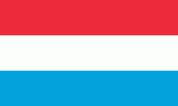
| Flag of Luxembourg | |
With an area of 2,586 km2, Luxembourg is one of the smallest countries in Europe, and the smallest not considered a microstate. In 2022, it had a population of 645,397, which makes it one of the least-populated countries in Europe, albeit with the highest population growth rate; foreigners account for nearly half the population. Luxembourg is a representative democracy headed by a constitutional monarch, Grand Duke Henri, making it the world's only remaining sovereign grand duchy.
Currency / Language
| ISO | Currency | Symbol | Significant figures |
|---|---|---|---|
| EUR | Euro | € | 2 |
| ISO | Language |
|---|---|
| FR | French language |
| DE | German language |
| LB | Luxembourgish language |


